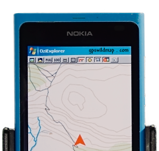
OziCE
Oziexplorer
gps maps

- Important: Maps for SmartcomGPS, SmartcomNavigator and CarMonitor
- How to buy / receive gps maps
- Haven't received the email with download access
- Download page, few tips
- Map code for SmartComNavigator
- Map code input problem
- Got rar-file instead of ozf2 ?
- Wrong rar-code..?
- GS-1 and PT-1 in a map name
- Privacy Policy
- Refund Policy
Note). Maps for such programs as SmartcomGPS, SmartcomNavigator, CarMonitor for licensed users only.
-). Gps maps for programs SmartcomGPS, SmartcomNavigator, CarMonitor will work for users with licensed versions for the mentioned products.
If you have a free version MapViewGPS etc... You need to buy a map for Oziexplorer (in ozf2 format)
then download free tool (Ogf2converter)
and convert OZF2 file into old OGF2 format.
Q). How to buy / receive gps maps?
A).To go directly to the Buy map click here.
1) your email address (to receive the confirmation/access notes).
2) The mapping software you use. (There are maps in two different map formats, so it's necessary to pick up the mapping software)
3) choose the maps you'd like to buy from the list.
PLEASE NOTE:
and include in the email body the Order ID (Order#) that you received with previous email right after a transaction is made.
ADDITIONAL DOWNLOAD INFO:
Q). Didn't receive an email response from you.
Similar). Just paid but haven't received the email with download access.
A). We respond to ALL emails. Check the Spam(Bulk) folder of your email account. Make SURE your SPAM control is OFF,
as most of the emails we send are automated,
and can be bounced from your ISP.
Also You may Include the email from our contact page in your email account's trusted contact list.
*) If you haven't logged in within 3 hours, an email with a download access will be forwarded to your email address again.
Q). Download page, few tips
A). Before the download, make sure that you disable (if any) the integrated into the browser additional downloaders (such as FlashGet, GetWright, DownloadMaster etc).
Q). Where should I put the map code you sent me?
A). If you use the older version of SmartComNavigator, please download and install the latest version (ver.1.06 or newer).
at http://smartcomgps.gpswildmap.com/
Notice, as for some versions of SmartComNavigator the Voice pack goes separetely, also download the "voice pack", if needed.
Q). I can enter only digits in map's serial number field, but map code contents letters too. Can You give me some advise?
A). Switch the phone in the text mode and English language by pressing [ * ] or [ Fn ] button, when the cursor on a text field (for different phones, different button)
or read the instruction manual of your phone, (text input section)
Q). I supposed to buy ozf2-map files, but downloaded one file with the RAR extension. What should I do now?
A). For convenience of downloading your order was packed into the rar-archive, depends on how big is your order the rar-archive may contain two or more files (..part1.rar,part2.rar, etc).
All you need is to copy all files into the same folder on your PC and unpack the archive by double-clicking on the first rar-file.
from http://www.rarlab.com/download.htm (the demo version is enough to unpack an archive)
Q). When I extract the rar file, and I put the code, the result said that is the wrong password. why..?
A).If you copy the code from a message, make sure that it doesn't contain the "space" character.
Q). What the meaning of GS-1 or PT-1 at the end of a map name?
A). The letters at the end of a map name stand for: GS - grid segment; GT - grid template; PT - map part;
'GS' or 'GT' it's a single map (county/province level), a part of a particular country that devided by segments (see GS-index).
*) GS-index is a list of maps of particular country. (for example: GS-1,GS-2,etc..).
'PT' - a part (single map) of a country map (usually a single standed island or destrict area that more detailed).
*) it doesn't affect a map visuallisation as a moving map software opens a needed part of a map automatically.
Maps can be devided:
-) England (map coverage - whole country)
-) England GS-1 or GT-1 (map coverage - one part of a country, see GS-index of that country)
*) possible: GS-2,GS-3 etc...
-) England PT-1 (map coverage - one part of a country, see GS-index of that country)
*) possible: PT-2,PT-3 etc...
-) England NORTH (map coverage - northern part of a country)
*) possible: SOUTH.
-) England WEST (map coverage - western part of a country)
*) possible: EAST.
-) England NW (map coverage - north-western part of a country)
*) possible: NE(north-east),SW(south-west),SE(south-east)
Privacy Policy
This policy covers how we use your personal information. We take your privacy seriously and will take all measures to protect your personal information.
Refund Policy
If you are not 100% satisfied with your purchase, you can either return your order for a full refund or exchange it for something else. You can return or exchange your purchase for up to 120 days from the purchase date. Returned or exchanged products must be in the condition you received them and in the original box and/or packaging.